Nature & Outdoors
Hiking
Updated
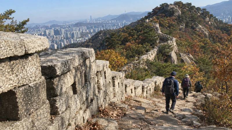
Most visitors hike in Korea as a half-day add-on to a city stay. In Seoul, walk the Seoul City Wall over Bugaksan or Inwangsan (2.5–3 hours) or climb Bukhansan (a full day); on Jeju, book the free Hallasan summit slot or walk a route of the Jeju Olle. Mountain trails have fixed entry hours, and many high trails close for fire season from about mid-November.
Hiking is a mainstream weekend pastime in Korea, so popular trails are busiest on Saturdays and Sundays, above all in October. Steps and handrails are common on steep granite, and most big cities have a trail you can reach by subway or bus.
Which hike fits your trip?
Pick by where you are sleeping and how much time you have.
| Your base and time | Hike | Distance and time | Level |
|---|---|---|---|
| Seoul, half day | City Wall, Baegak section (Bugaksan) | 4.7 km, about 3 h | Steep stairs |
| Seoul, half day | City Wall, Inwang section (Inwangsan) | 4.0 km, about 2.5 h | Moderate |
| Seoul, full day | Bukhansan to Baegundae (836 m) | Full day | Hard near the top |
| Busan, half day | Galmaetgil coastal sections; Oryukdo cliff path | 2–4 h per section | Easy to moderate |
| Jeju, one day | Hallasan summit (booking needed) | Full day | Hard |
| Jeju, half day | One Jeju Olle route, or Seongsan Ilchulbong | 30 min to a full day | Easy to moderate |
| East coast, 1–2 days | Seoraksan from Sokcho | Half day to full day | Moderate to hard |
City Wall distances and times from the Seoul City Wall office; checked 14 October 2026. If you have one free morning in Seoul, the City Wall is the easiest win: no special gear, views over the palaces, and buses back to the centre. Save Bukhansan or Seoraksan for a day you can start early.
Easy hikes in central Seoul
The Seoul City Wall (Hanyangdoseong) runs for 18.6 km over the four inner hills of the old capital, and the trail beside it is split into four sections. Two are proper hikes:
- Baegak section (Changuimun → Hyehwamun): 4.7 km, about 3 hours, rated the hardest of the four. From Gyeongbokgung Station Exit 3, take green bus 7212, 1020 or 7022 to the Jahamun Pass stop. It ends near Hansung University Station (Line 4).
- Inwang section (Donuimun site → Changuimun): 4.0 km, about 2.5 hours, with wide views over Gyeongbokgung and the city.
- Naksan (3.2 km, about 1.5 hours) and Namsan (6.7 km, about 3.5 hours) are gentler walks through neighbourhoods and parkland.
The wall path is open around the clock, but the office recommends walking the Baegak section 09:00–17:00 in November–February, 07:00–18:00 in March–April and September–October, and 07:00–19:00 in May–August. There are no toilets for about two hours once you start the Baegak or Inwang sections and no convenience stores on the way, so buy water before you set off. Do not climb on the wall itself.
For a longer challenge, the Seoul Trail circles the whole city: 156.5 km in 21 courses averaging about 8 km, mostly through forest. Stamp books are free at the trail information centres and Seoul City Hall, and collecting all 28 stamps earns a completion certificate.
Borrow hiking gear in Seoul
Few visitors pack boots for a city trip. The Seoul Tourism Organization runs three Seoul Hiking Tourism Centers that rent hiking gear to foreign visitors and to Koreans hiking with them, and offer coin lockers, a lounge and trail information. Reserve gear through the centres’ website.
| Centre | Where | Closed |
|---|---|---|
| Bukhansan | 5F, 52 Samyang-ro 173-gil, Gangbuk-gu | Mondays |
| Bugaksan | 1F, 88 Samcheong-ro, Jongno-gu | Tuesdays |
| Gwanaksan | B1, inside Gwanaksan Station, Gwanak-gu | Wednesdays |
All three open 09:00–18:00 and also close on major holidays; checked on the official site 14 October 2026. Rental prices are not published on the centres’ own pages, so check the booking page before you go.
Long-distance walking trails
Korea also has signed long-distance trails, built for walking one day-length stage at a time. You do not need to walk them end to end.
- Jeju Olle Trail: 27 routes, about 437 km, looping Jeju’s coast, including routes on small offshore islands. The first route opened in 2007. For a single day, the southern routes around Seogwipo are a popular choice.
- Busan Galmaetgil: 278.8 km in nine courses, split into shorter sections along Busan’s coast, rivers and hills. In summer the trail office advises walking before 09:00 or in the evening, and telling someone your route if you walk alone.
- Korea Dulle-gil: a walking route of about 4,500 km around the whole country, made of four trails — Haeparang (east coast, from Busan’s Oryukdo to Goseong in Gangwon), Namparang (south coast), Seohaerang (west coast) and the DMZ Peace Trail. The Korea Tourism Organization’s Durunubi app and website show every course with QR stamp points.
Trail hours, closures and rules
In national parks, each trail has an entry window: you may start from a set time before dawn, but must pass the control point before the last-entry time, which moves earlier in winter. Bukhansan’s Baegundae route from the Baegun centre, for example, is open 04:00–16:00 in December–February and 04:00–17:00 the rest of the year. Many high trails also close for wildfire prevention; in 2025 the autumn closures ran from 15 November to 15 December. The details for each park are on our national parks page.
- Stay on marked trails; closed trails are fined.
- No cooking, campfires, smoking or camping outside designated sites.
- Drinking on summits is a target of ranger patrols.
- In summer, start early and carry plenty of water; heat and humidity are the main risk on exposed ridges and coastal boardwalks.
- If you walk alone, tell someone your route. The emergency number for rescue and ambulance is 119.
What to bring
Trainers or light trail shoes are fine on the City Wall and most Olle routes; Bukhansan, Seoraksan and Hallasan need proper hiking boots for bare granite and rocky steps. From December to March, carry light crampons: shaded stretches are icy even when the city has no snow. Bring a refillable bottle, a snack, a T-money card for buses to the trailhead, and a layer for the summit wind. For buses, subways and cards, see the transportation guide.
Book your trip
Best hiking in Korea
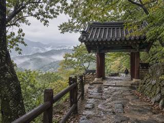
Seokguram Grotto 석굴암
A granite Buddha in an artificial cave grotto high on Tohamsan, viewed through glass; reach it by bus or a mountain trail.
Gyeongju · Gyeongsang ·
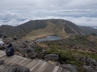
Hallasan 한라산
South Korea's highest peak. A long day hike leads to the Baengnokdam crater; summit trails need advance booking.
Jeju Island · Jeju ·
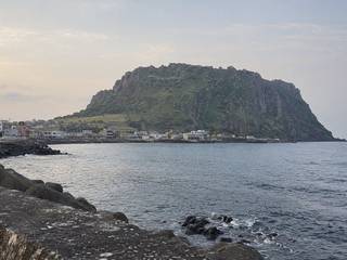
Seongsan Ilchulbong 성산일출봉
A steep tuff cone rising from the sea at the eastern tip, climbed by a stair path to a vast grassy crater.
Jeju Island · Jeju ·
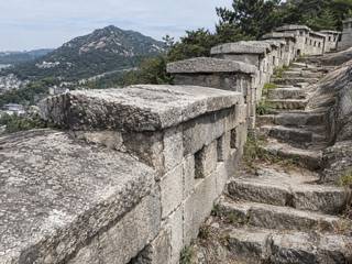
Seoul City Wall Trail 한양도성 순성길
An 18.6 km loop along the Joseon-era wall over four inner hills; the Baegak (4.7 km, about 3 hours) and Inwang (4.0 km) sections are real ridge hikes above the palaces.
Seoul · Seoul ·
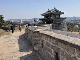
Hwaseong Fortress walls 수원 화성
King Jeongjo's 1790s fortress loop of gates, towers and ramparts, 5.74 km long; UNESCO-listed in 1997, free and open at all hours.
Suwon · Gyeonggi & Incheon ·
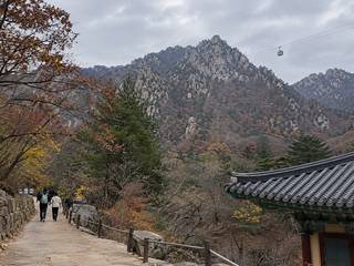
Seoraksan National Park 설악산국립공원
Granite peaks topped by Daecheongbong (1,708 m), a UNESCO biosphere reserve since 1982; easy trails start at Seorak-dong.
Sokcho · Gangwon ·
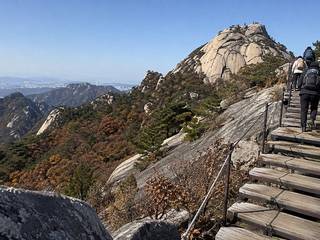
Bukhansan National Park 북한산국립공원
Granite peaks on the northern city edge with trails to Baegundae summit, an old mountain fortress and hillside temples.
Seoul · Seoul ·
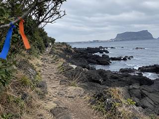
Jeju Olle Trail 제주올레길
A long-distance walking route circling the island in numbered day-length courses; the Seogwipo sections are favourites.
Jeju Island · Jeju ·
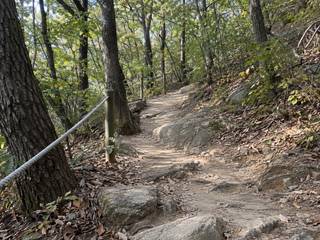
Seoul Trail 서울둘레길
A 156.5 km loop around the edge of Seoul in 21 courses averaging about 8 km, mostly forest paths, with 28 stamp points and a free completion certificate.
Seoul · Seoul ·
Jeongdong Simgok Badabuchae-gil 정동심곡바다부채길
A 3 km boardwalk and steel walkway along a raised coastal terrace, a natural monument; ₩5,000, closed in bad weather.
Gangneung · Gangwon ·
Ulsanbawi Rock 울산바위
Granite pinnacles at the end of a 3.8 km trail from Sogongwon, the last part on long stairs; allow about 4 hours there and back.
Sokcho · Gangwon ·
Biseondae and Geumganggul 비선대 금강굴
An easy 3 km valley walk from Sogongwon to the smooth rock pools of Biseondae, with a steep 0.6 km climb on to the Geumganggul cave.
Sokcho · Gangwon ·
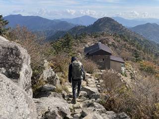
Jirisan National Park 지리산국립공원
The classic multi-day ridge walk, from Nogodan to Cheonwangbong (1,915 m), with mountain shelters allocated by lottery.
Gurye / Sancheong · Jeolla ·
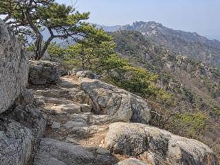
Palgongsan National Park 팔공산국립공원
Granite ridge north-east of Daegu, a national park since December 2023; a cable car climbs to 820 m and leaves peak in late October.
Daegu · Gyeongsang ·
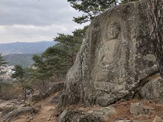
Gyeongju Namsan 경주 남산
A sacred mountain dotted with Buddhist rock carvings, stone pagodas and temple sites, explored on well-marked hiking trails.
Gyeongju · Gyeongsang ·
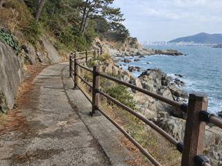
Busan Galmaetgil 부산 갈맷길
Busan's 278.8 km walking network in nine courses, broken into short sections along the coast, rivers and hills; easy to sample in half a day.
Busan · Busan ·
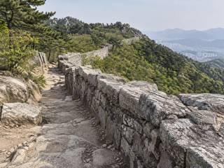
Geumjeongsan National Park 금정산국립공원
Ridge walks along the walls of Geumjeongsanseong fortress on Busan's northern edge; Korea's newest national park since 3 March 2026.
Busan · Busan ·
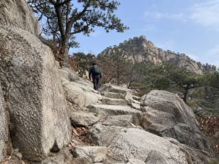
Gwanaksan 관악산
Rocky granite mountain on Seoul's southern edge, with a city-run hiking centre inside Gwanaksan Station for gear rental and lockers.
Seoul · Seoul ·
Muuido 무의도
A hilly island joined to Yeongjong by bridge, with Hanagae Beach, low-tide walks to Silmido and a 245 m summit trail.
Incheon · Gyeonggi & Incheon ·
Biryong Falls and Towangseong Falls viewpoint 비룡폭포 토왕성폭포 전망대
An easy 2.4 km trail past Yukdam Falls to Biryong Falls, then up to a viewpoint for Towangseong Falls on the far cliff.
Sokcho · Gangwon ·
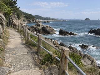
Haeparang Trail 해파랑길
The east-coast arm of the Korea Dulle-gil, running from Oryukdo in Busan north to Goseong in Gangwon; most visitors walk a single course near their base.
Busan to Goseong · Gangwon ·
Geumodo Bireong-gil 금오도 비렁길
An 18.5 km cliff-top trail on Geumodo island in five sections, reached by ferry; allow a full day, or walk one section.
Yeosu · Jeolla ·
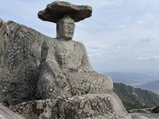
Gatbawi Stone Buddha 갓바위 (관봉 석조여래좌상)
A seated stone Buddha with a flat stone 'hat' on a Palgongsan summit, reached by a 1.6 km climb of about an hour.
Daegu · Gyeongsang ·
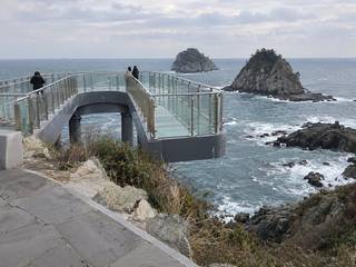
Oryukdo Skywalk 오륙도 스카이워크
A short glass-floored walkway over sea cliffs facing the rocky Oryukdo islets, where the Haeparang coastal trail begins.
Busan · Busan ·
Frequently asked questions
What is the best hike in Seoul for a first-time visitor?
For a half day, walk the Baegak or Inwang section of the Seoul City Wall: 4–5 km and 2.5–3 hours each, both starting a short bus or subway ride from Gyeongbokgung. For a full day and a real summit, climb Bukhansan's Baegundae (836 m).
Can tourists rent hiking gear in Seoul?
Yes. The Seoul Hiking Tourism Centers at Bukhansan, Bugaksan and Gwanaksan rent gear to foreign visitors (and Koreans hiking with them), open 09:00–18:00. Book on the centres' website; each centre closes one weekday.
Do you need a permit to hike in Korea?
Not for most trails, and national parks charge no admission. The main exception is Hallasan on Jeju, where the summit trails need a free advance booking. Mountain trails do have fixed entry hours.
When is the best time to hike in Korea?
October and early November for clear air and autumn colour, and April–May for spring green. Summer is hot and humid with monsoon rain; winter trails are icy and need crampons. High trails in many parks close for fire season, usually from mid-November to mid-December.
How long is the Jeju Olle Trail?
About 437 km in 27 routes looping the island's coast, including island routes. Most visitors walk one or two routes as day walks rather than the whole loop.
Sources
Facts on this page were checked against these sources on 14 October 2026. Prices, hours and rules change — confirm with the operator before you go.
- Seoul Hiking Tourism Center — centres, opening hours, gear rental (English) · official
- 서울등산관광센터 — 센터 안내, 등산 물품 대여 (Korean) (Korean) · official
- 서울 한양도성 — 백악구간 코스 안내 (거리, 소요시간, 계절별 탐방 권장시간) (Korean) · official
- 서울 한양도성 — 순성 안내 유의사항 (Korean) · official
- 서울특별시 — 서울둘레길 2.0, 21개 코스 156.5km 개편 (Korean) · official
- Jeju Olle Foundation — Jeju Olle Trail (English) · official
- 제이누리 — 제주올레 27개 코스 437km 완주 기사 (2026) (Korean)
- 두루누비 (한국관광공사) — 코리아둘레길 약 4,500km (Korean) · official
- 문화체육관광부 — 해파랑길, 부산 오륙도~강원 고성 (보도자료, 2016) (Korean) · official
- 부산 갈맷길 — 278.8km, 코스 안내, 폭염 안전 이용 안내 (2026) (Korean) · official
- Korea National Park Service — Trail entry-time system (입산시간지정제) (Korean) · official
- Kyunghyang Shinmun — national park autumn fire-season closures, 15 Nov–15 Dec 2025 (Korean)